


The Beaver Impacts Tool is a web app developed by the Beaver Lab at Collaborative Earth to help land managers and researchers understand the impact of beavers and beaver-based restoration on their land.
The tool allows users to:
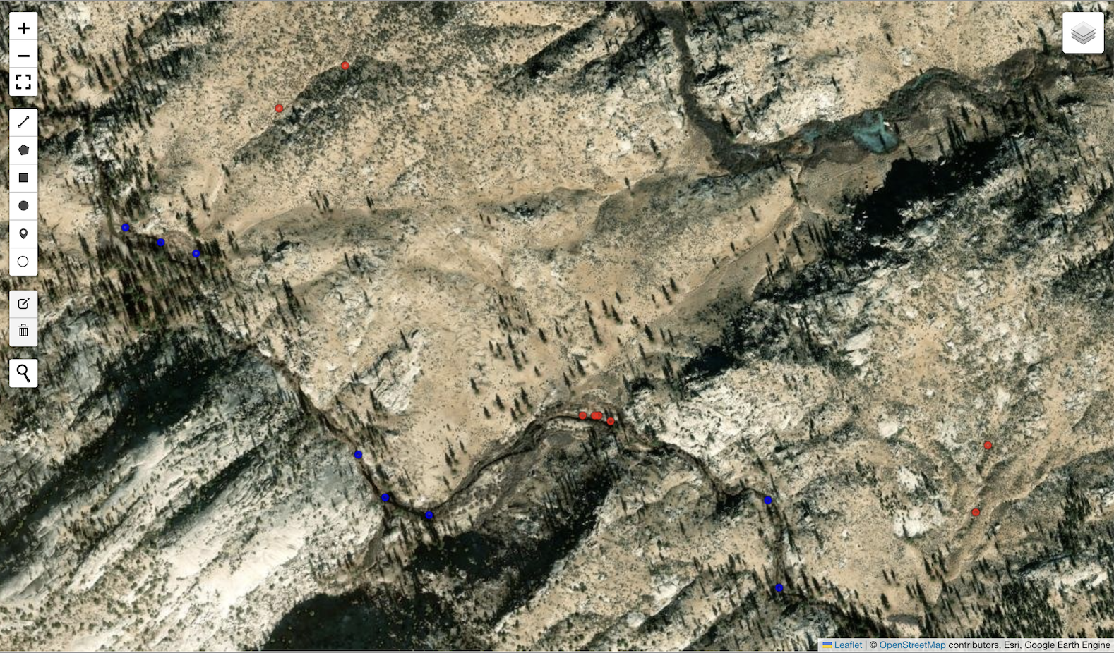
-Upload locations of observed dams or installed beaver dam analogs.
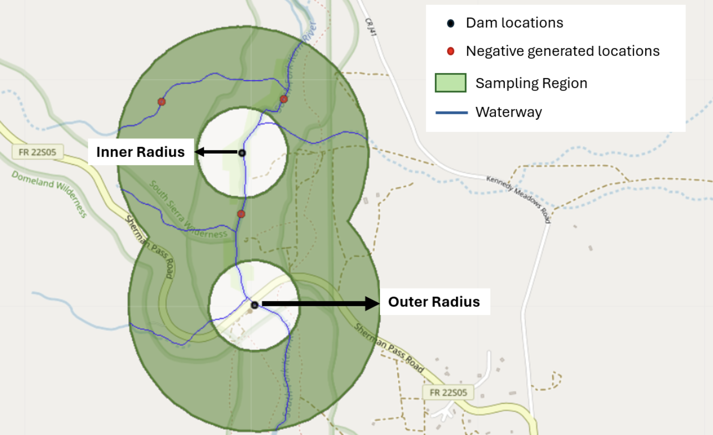
-Upload or generate nearby locations without dams for comparison.
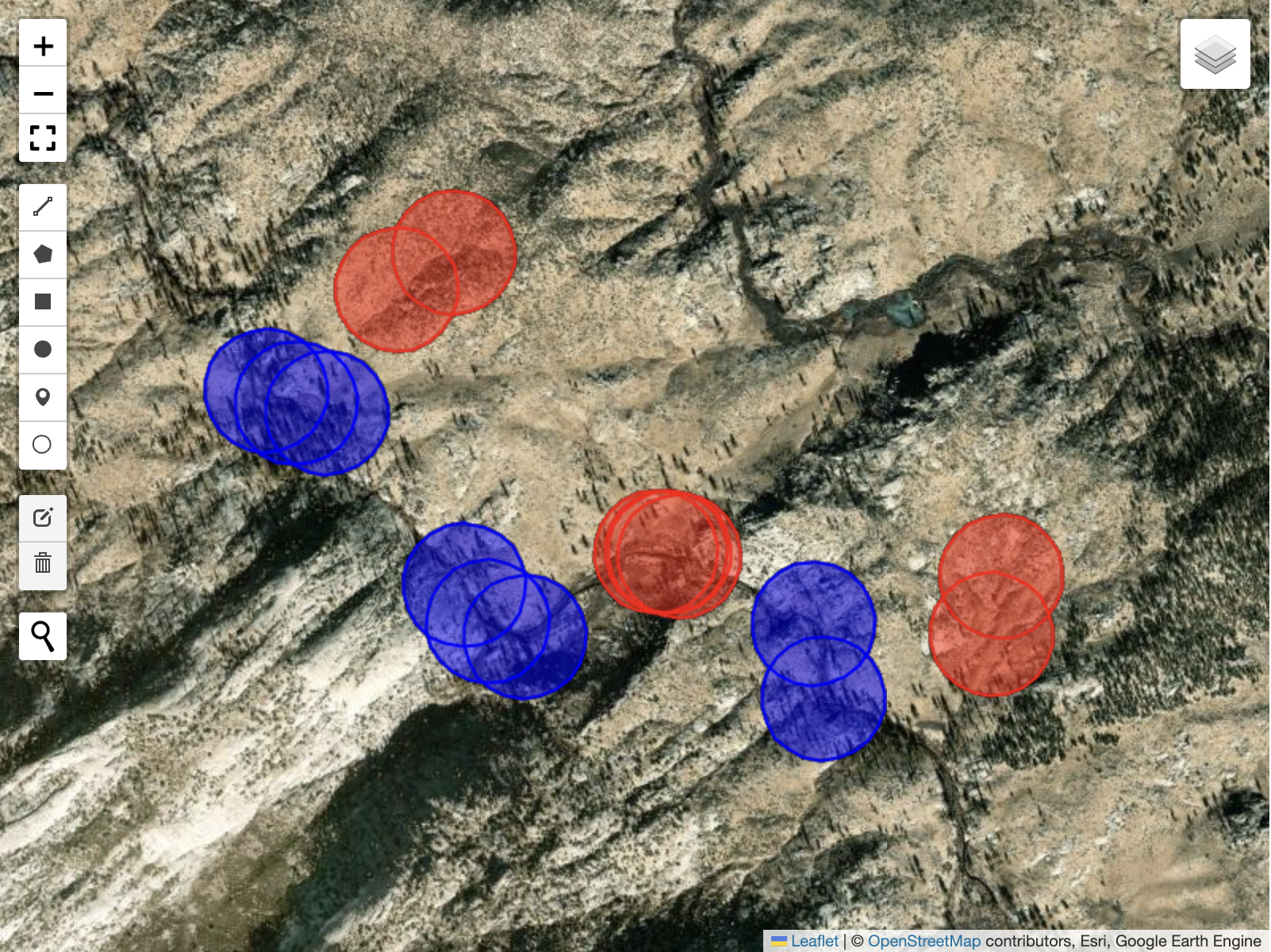
-Pull satellite imagery for the provided locations for a given year.
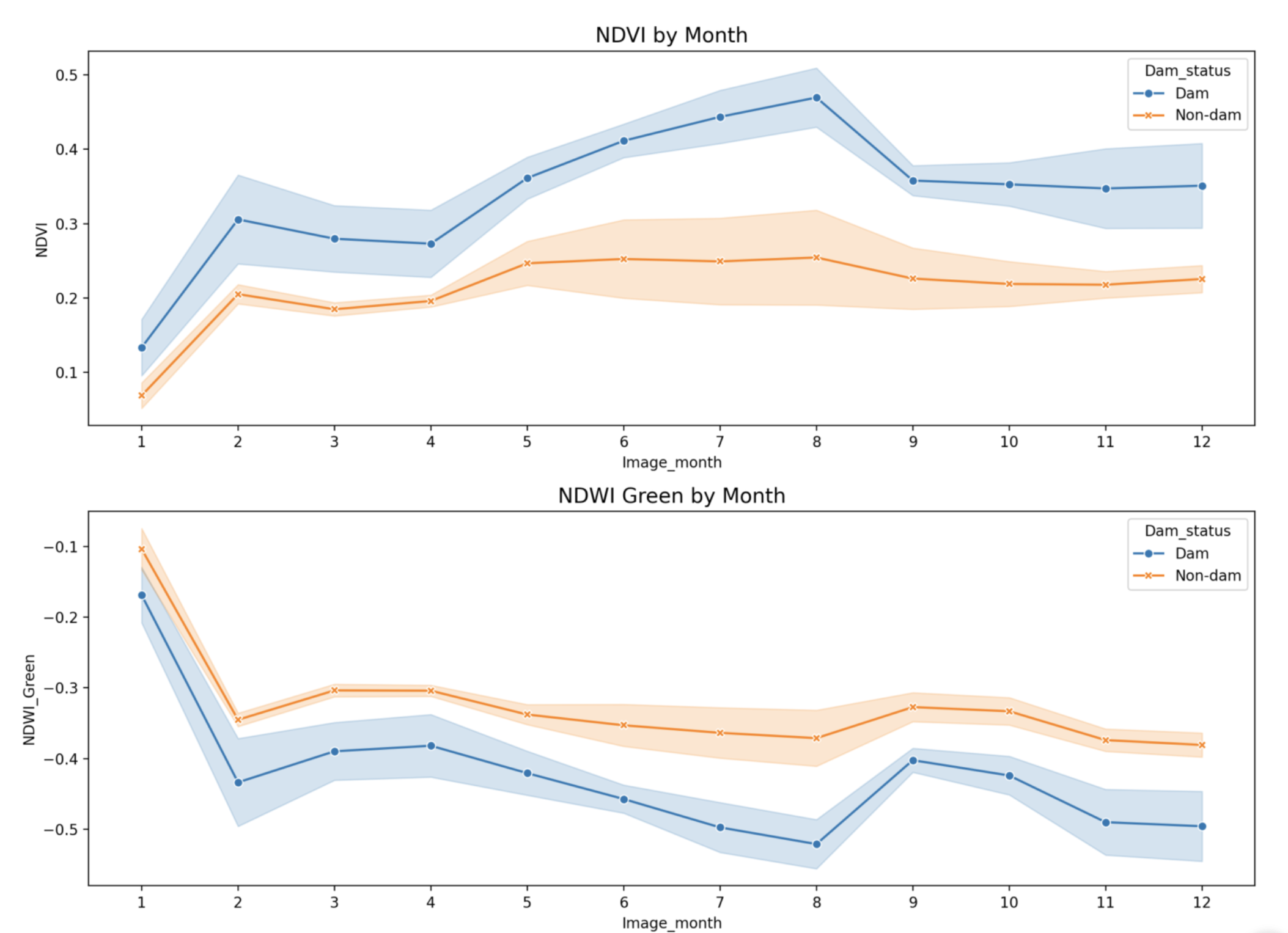
-Make plots of vegetation and water indices, temperature, and evapotranspiration over the course of one or multiple years, comparing dam to no-dam locations.
-Download plots and/or raw data.
-